Long-term Comparative Traffic Data
Colwood's traffic monitoring system provides an ever-growing dataset that provides historical and comparative travel times and speeds on each collection route. The data allows us to understand the normal performance of a route, note anomalies, make adjustments, measure the impact of adjustments, and inform broader transportation plans. Data can be used to guide road and sidewalk improvements, transit upgrades, traffic signal timing and overall traffic modeling.
Monitoring traffic flow in real time
The City of Colwood uses Bluetooth technology as one tool to monitor traffic flow and inform transportation improvements.
The system receives anonymous signals from cell and in-car systems to provide real-time data about vehicle travel routes, times and the average speed of vehicles between various detection points in the city.
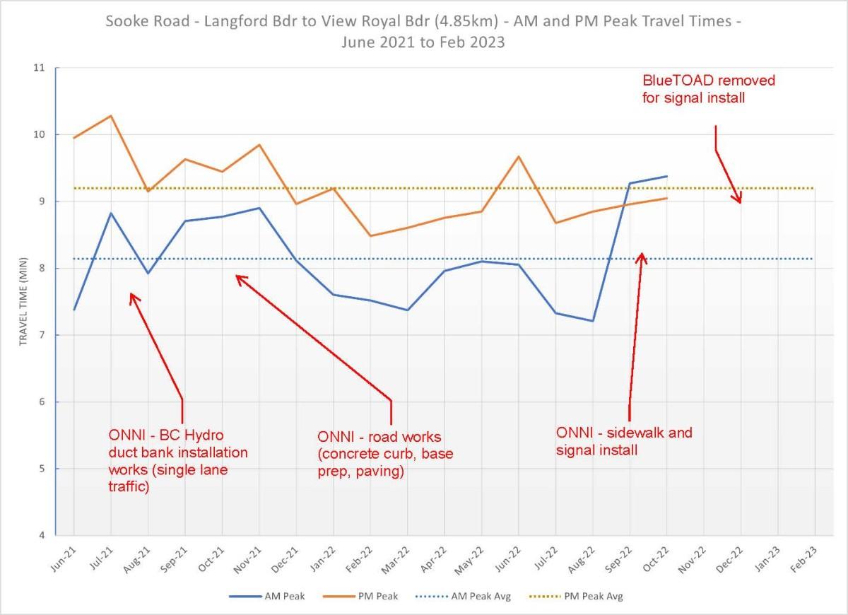
How does road construction affect travel times?
Sooke Road from Jacklin Road to the View Royal border: Data shows the average morning peak travel time is just over 8 minutes and average afternoon peak travel time is just over 9 minutes. Recent toad works at Colwood Corners increased travel times by about 1 minute as shown below.
Veterans Memorial Parkway from Sooke Road to Latoria Road [PDF/403KB]: Data shows the average morning peak travel time is just under 3 minutes and average afternoon peak travel time is just over 3 minutes. Recent road works at the Allandale District and intersection works at Veterans and Latoria increased travel times by about 1 minute or less as shown below.

Pedestrian and Cycling Data
The CRD has a counter on the Galloping Goose Regional Trail at Wale Road that provides insight into pedestrian and cycling activity in Colwood. In 2021 the count of trail users totaled 277,823, an average of 761 pedestrians and cyclists every day. View the data.